
We’ve made it to the final weekend of March but unfortunately our weather won’t be spectacular to say the least.
An incoming disturbance from our west along with high pressure over the Atlantic, which has been responsible for this ongoing windy weather, will draw up moisture from our south and enhance our rain chances this weekend.
With that said, this weekend won’t be a washout. At the very least, it will be mostly cloudy while the breeze decreases.
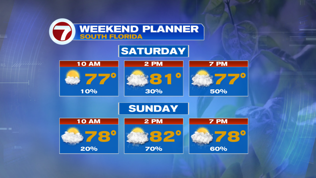
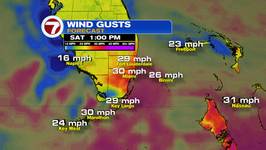
Winds will still be fairly strong this Saturday with gusts up to around 30 mph, then it drops down to around 20 mph Sunday with even lighter winds by early next week.
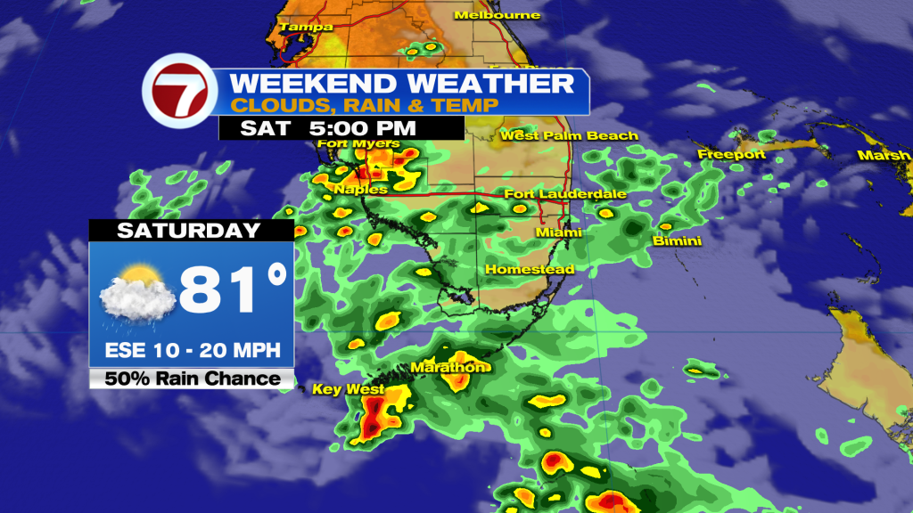
For our Saturday, expect clouds and just a few peeks of sunshine with a rising chance for scattered showers from south to north as the day progresses. Even an isolated thunderstorm will be possible.
Spotty showers will be possible to then start the day Sunday, but I think activity will really start to ramp up around midday with scattered to numerous showers and thunderstorms expected during the afternoon hours.
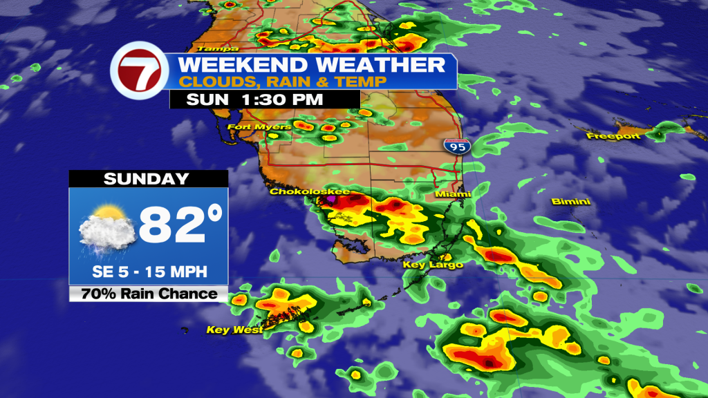
Humidity levels will be noticeably higher come Sunday, helping aid in the risk for storms.
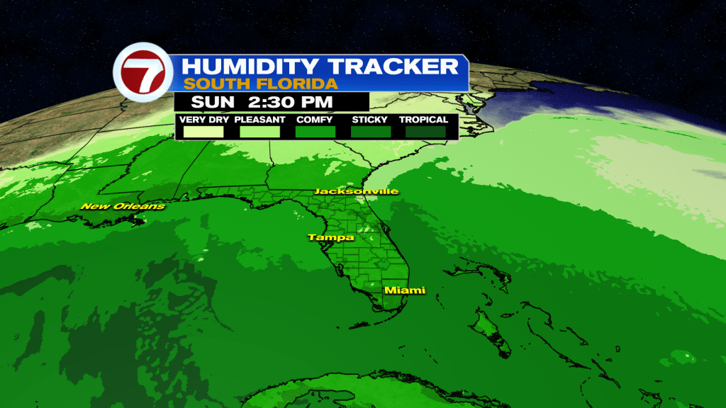
That humidity will remain high most of next week, a sign of the very warm week we go ahead of ourselves. Highs next week will hover in the mid to upper 80s with lows holding above average in the low to mid 70s.
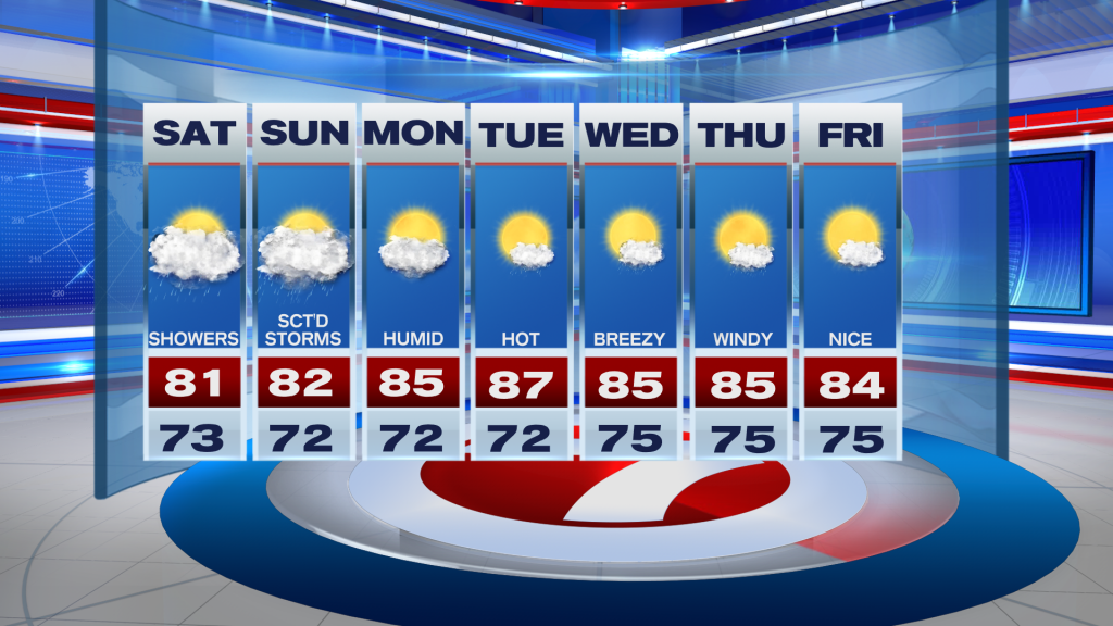
Besides the occasional, isolated shower or storm throughout the week, it will be nice and bright with a good amount of sunshine.
(Except for the headline, this story has not been edited by PostX News and is published from a syndicated feed.)