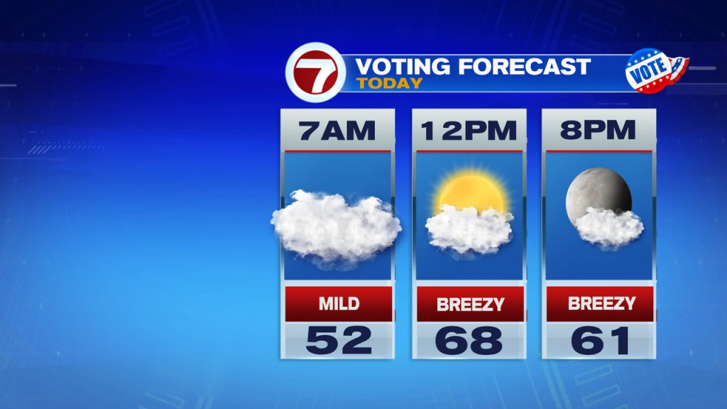
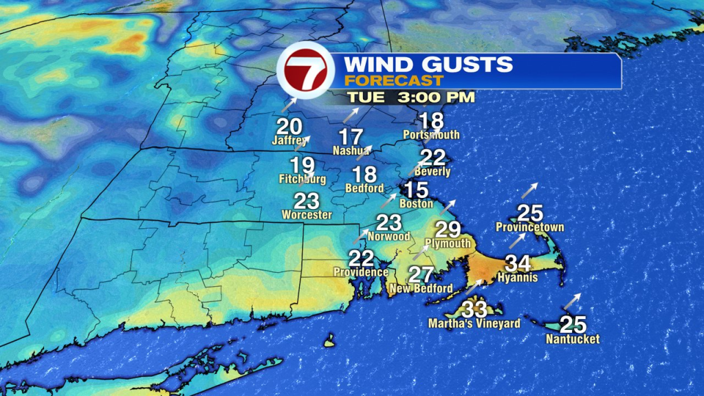
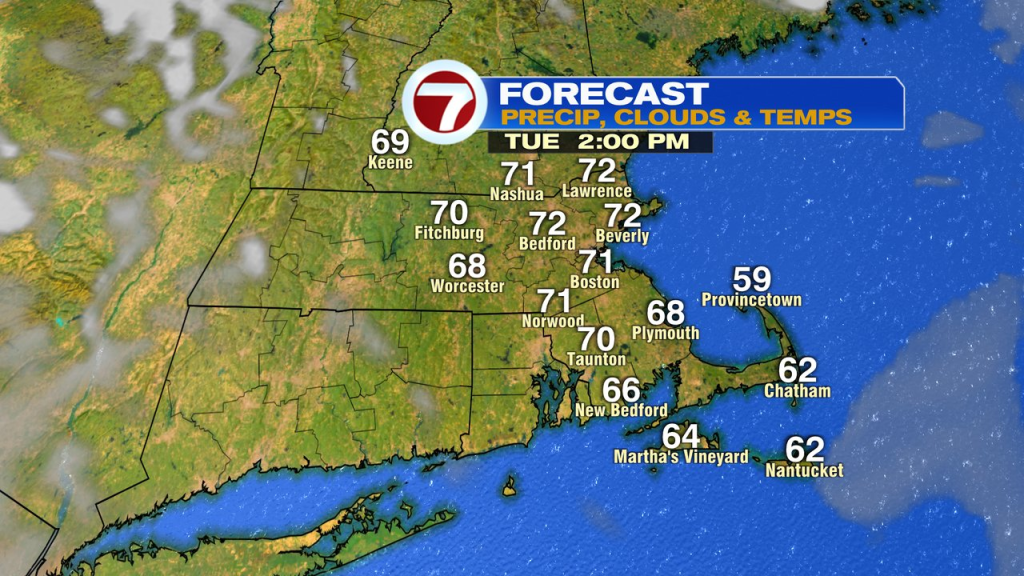
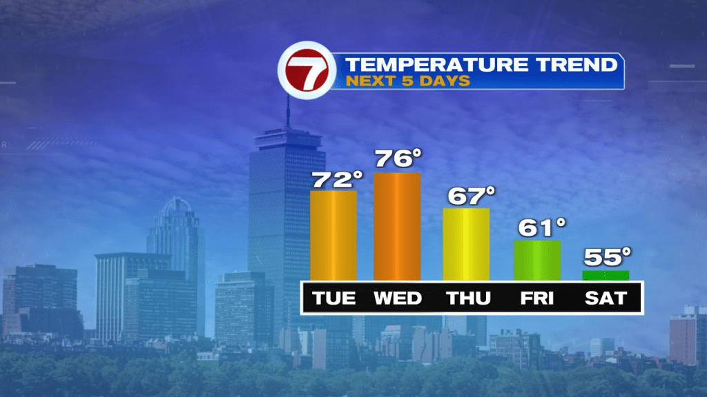
It’s a big difference this morning with temps running in the low to mid 50s vs the heavy frost we had yesterday morning. In many towns and cities, temps start 25-30 degrees warmer than yesterday morning. We’ll continue the trend to the up side, into the upper 60s and lower 70s on this Election Day. While a few sprinkles/light showers traverse NH and northern MA this morning, drops are few and far between. Morning clouds tend to yield to developing sun mid to late morning too. The afternoon looks bright. Temps linger into the low 60s early this evening, so it’ll be comfortable heading out to the polls after work too. It’ll be breezy too, with gusts 20-30mph out of the southwest.
It’s mild overnight tonight with temps holding in the mid 50s to lower 60s. Patchy low clouds form, and those hold on until tomorrow morning.
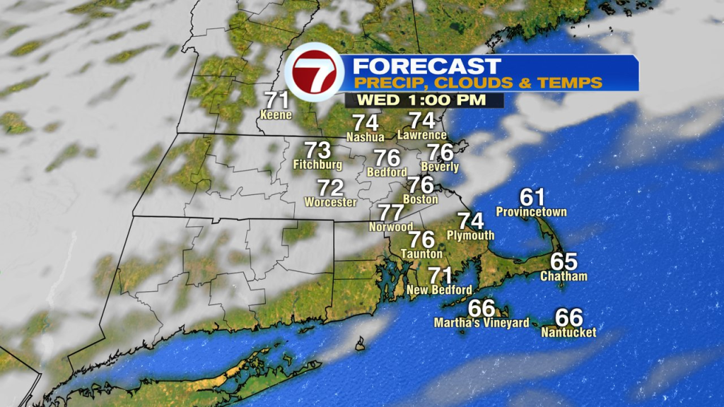
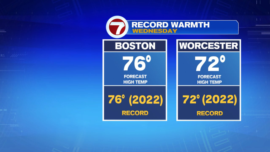
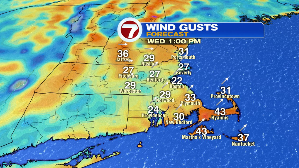
Low clouds break for some sun tomorrow as highs surge to near record highs of 76 in Boston and 72 in Worcester. The wind will be very gusty, 25-35mph out of the southwest. It’ll stay dry. With the lower relative humidity and dry, gusty breezes the next couple of days, the brush fire risk will be elevated.
Temps trend back toward seasonable levels by the weekend. A few scattered showers are possible by Sunday night/Monday morning. Otherwise the pattern remains very dry.
(Except for the headline, this story has not been edited by PostX News and is published from a syndicated feed.)
