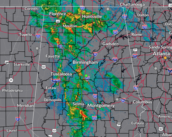
As of 12:34am, radar is looking better than what we were seeing at 10pm, as the rain activity has lessened in intensity. However, locations that have already seen plenty of rain today, continue to see rain at this time. There is only one active Flash Flood Warning, and that is for parts of Bibb, Chilton, Perry, and Dallas Counties.
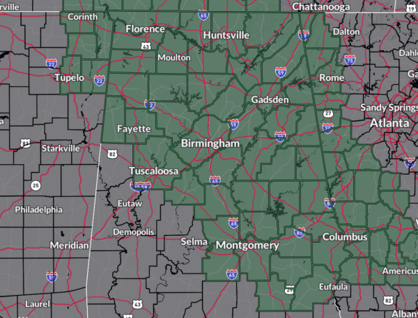
With that being said, we are still expecting plenty of rain again on Saturday, maybe more to the eastern side of the state. A Flood Watch continues for all the North Alabama counties and for most of the Central Alabama counties until Saturday afternoon.
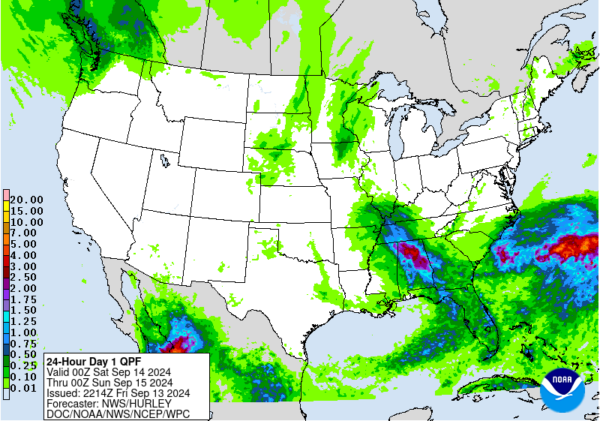
The latest QPF map from the NWS WPC shows that locations over the northwest to the southeast mainly along I-22 and US-280 potentially could see rain totals of 2–4 inches, while the rest of the state may see 1 inch or less. The good news is that there are no severe storms expected on your Saturday, as the potential for flooding issues will be the main focus. We will have lost the helicity needed for severe storms to form, even though there will be enough surface-based instability for thunderstorm formation and fuel for them to survive for a good while.
Category: Alabama’s Weather, ALL POSTS, Severe Weather, Social Media
About the Author (Author Profile)
Scott Martin is an operational meteorologist, professional graphic artist, musician, husband, and father. Not only is Scott a member of the National Weather Association, but he is also the Central Alabama Chapter of the NWA president. Scott is also the co-founder of Racecast Weather, which provides forecasts for many racing series across the USA. He also supplies forecasts for the BassMaster Elite Series events including the BassMaster Classic.
(Except for the headline, this story has not been edited by PostX News and is published from a syndicated feed.)


