
News Center Maine graphic
We’re parched, and finally, some rain is coming.
The period from September 1 through November 20 was the driest on record in Bangor (2.79″) and Caribou (3.58″), and the second driest on record in Portland (3.73″).
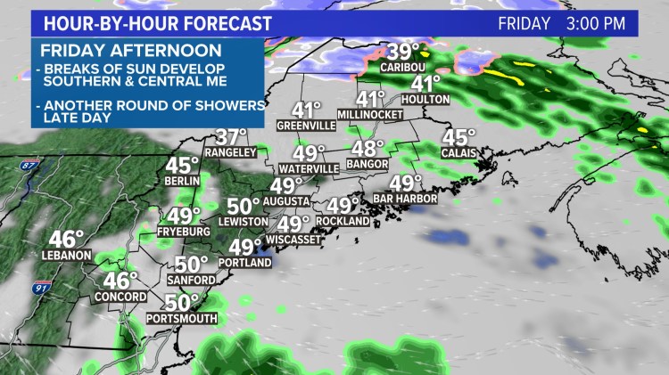
A slow-moving storm system will bring waves of rain over the next couple of days. The first round is early Friday morning, as a band of showers and downpours moves from south to north through the state. This could be accompanied by wind gusts of 30-40 mph for a brief period of time around daybreak, especially near the coast.
This band of rain will be progressing north through the morning, and it will turn drier for the middle of the day. Parts of southern Maine may see some sunshine for a while too. Meanwhile, clouds and showers will continue in northern Maine.
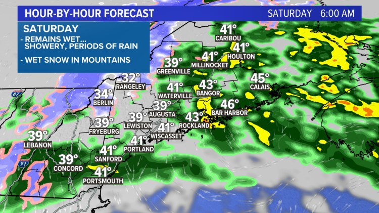
Any break in the rain won’t be too long-lasting. Showers re-develop Friday night into Saturday.


News Center Maine graphic
As the storm system pulls away Saturday, colder air will get wrapped into Maine. The higher elevations of the White Mountains and western Maine will likely see some wet snow late Friday night into Saturday. While wet flakes could mix in with rain in lower elevations, the majority of the accumulation will be in the higher terrain, where several inches are possible.
In total, a widespread one to two inches of rain is expected; locally higher amounts are possible. We need every drop we can get!
Heading into Thanksgiving, there is a weak system that may bring mixed rain and snow showers on Tuesday.
Wednesday and Thanksgiving Day itself look dry, but there is a potential system on Black Friday. At this point, being so far out, there is plenty of time for this to change. Don’t buy into any social media hype! However, it’s worth keeping an eye on, and if it becomes something to be more concerned about, we will let you know.
(Except for the headline, this story has not been edited by PostX News and is published from a syndicated feed.)

