

We have some isolated to scattered showers out there across mainly western Alabama, but a few showers can be seen over the eastern half. Otherwise, skies are mostly cloudy across Alabama. At least the temperatures are relatively nice at this time, ranging from the mid 60s to the upper 70s, which are rather close to our daytime highs for today. We’ll continue to have the risk of scattered showers, and maybe just a few rumbles of thunder for the remainder of your Saturday, even during the late night and overnight hours. Lows will only fall to the upper 50s to the mid 60s.
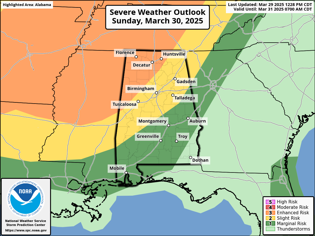
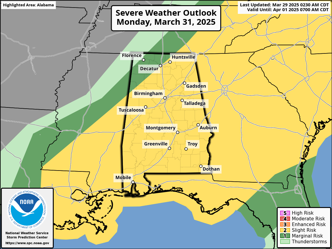
UPDATE ON SUNDAY/MONDAY’S SEVERE WEATHER THREAT: The SPC has expanded the Enhanced Risk on Sunday eastward to now include all of northwest Alabama west of a line from Gurley to Cullman to Geiger. The Slight Risk remains untouched, as it stretches as far east and south as from Fruithurst to Billingsley to just west of Coffeeville. A Marginal Risk is up for nearly the rest of the state except for the extreme southeastern corner. The severe risks for Monday remain unchanged for the moment. The severe weather risk graphics are valid from 7AM to 7AM the next day; that is why the risks are there on Sunday’s graphic.

It now looks like the severe weather threat window will need to be pushed a little later with the start times, and thank you to our good friend, Jim Stefkovich, at the Alabama EMA office for this graphic. For the northwest corner of the state, we can expect the threat window to be from 12AM to 8AM, with north-central portions of the area from 3AM to 9AM, Central Alabama from 5AM to 1PM, much of South Alabama from 9AM to 3PM, and the southeast corner of the state from 11AM to 5PM. No changes to the actual threats, as tornadoes, damaging winds, and large hail will be possible if storms become severe. A stronger tornado or two will be possible in the Enhanced Risk locations during the predawn hours on Monday morning. Make sure you have at least two methods to receive severe weather warnings that can wake you up during the night, one of which is NOT an outdoor siren.
Sunday’s highs will be in the lower 70s to the lower 80s, with pretty similar temperatures on Monday until the front passes your location. However, the cooldown behind the front will only be by a couple of degrees.
Category: Alabama’s Weather, ALL POSTS, Severe Weather
About the Author (Author Profile)
Scott Martin is an operational meteorologist, professional graphic artist, musician, husband, and father. Not only is Scott a member of the National Weather Association, but he is also the Central Alabama Chapter of the NWA president. Scott is also the co-founder of Racecast Weather, which provides forecasts for many racing series across the USA. He also supplies forecasts for the BassMaster Elite Series events including the BassMaster Classic.
(Except for the headline, this story has not been edited by PostX News and is published from a syndicated feed.)