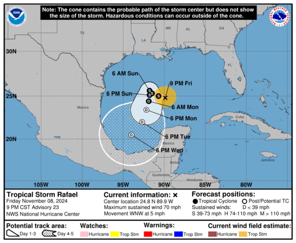
As expected, what was once major hurricane Rafael has rapidly weakened to a high end tropical storm. Sustained winds are now down to 70mph, and the WNW movement has slowed to just 5 mph. The rest of the forecast remains fairly similar, with continued weakening an an eventual sharp turn towards Mexico late in the weekend. No impact to the U.S. is expected other than the possibility of rip currents.
Current Rafael stats:
LOCATION...24.8N 89.9W
ABOUT 240 MI...390 KM N OF PROGRESO MEXICO
ABOUT 460 MI...745 KM E OF MOUTH OF THE RIO GRANDE
MAXIMUM SUSTAINED WINDS...70 MPH...110 KM/H
PRESENT MOVEMENT...WNW OR 285 DEGREES AT 5 MPH...7 KM/H
MINIMUM CENTRAL PRESSURE...989 MB...29.21 INCHES
Behind Rafael, an area of thunderstorms continues to be monitored by the National Hurricane Center near the Leeward Islands. As of this forecast advisory, they keep the chances of development low, at only 10%. We will continue monitoring this over the coming days.
Category: ALL POSTS, Social Media, Tropical
(Except for the headline, this story has not been edited by PostX News and is published from a syndicated feed.)

